|
search place name
|
||
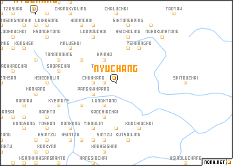
Nyu-chang (Shan, Myanmar)Nyu-chang is a town in the Shan region of Myanmar. An overview map of the region around Nyu-chang is displayed below.
regional and 3d topo map of Nyu-chang, Myanmar ::
Nyu-chang airports ::
The nearest airport is LSH - Lashio, located 138.4 km south west of Nyu-chang.
Other airports nearby include MYT - Myitkyina (211.5 km north west), Nearby towns ::
Shuikaw Chai (1.7km west) //
Tingkangho (2.5km north west) //
Mān Hin (3.4km west) //
Chuhkang (3.4km west) //
Lunghtang (4.1km south west) //
Hpinho (4.1km north west) //
Pangkwi-hpang (3.9km south west) //
Mifung Chai (5.8km north) //
Kaochia Chai (5.8km south) //
Hsieo-htang (6.3km south west) //
Pai-htang (6.3km north west) //
Yehwangpo (6.5km north east) //
Wonghsi Chai (7.4km south) //
Hsi-choling (7.6km north) //
Kaochia Chai (8.2km south east) //
Yi-hawlin (8.2km south west) //
Lao-paw Chai (8.2km north west) //
Malushui (8.8km north west) //
Ngeo-kunhtang (10.0km north east) //
Mān Kang (10.0km south west) //
[all distances 'as the bird flies' and approximate] 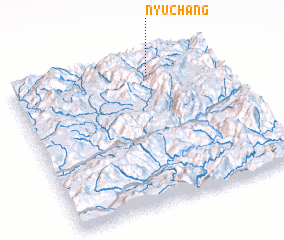
Disclaimer :: Information on this page comes without warranty of any kind |
||
|
Where is Nyu-chang? Elevation and coordinates ::
Latitude (lat): 23°54'0"N Longitude (lon): 98°40'0"E
Elevation (approx.): 1560m (map arrows pan, magnifying glasses zoom) |
||
|
Visiting Nyu-chang? Hotel/Accommodation ::
Book a hotel in Nyu-chang Travel Guide ::
Buy a travel guide for Myanmar rental cars ::
car rental offers GPS waypoint ::
download a GPX waypoint (PoI) of Nyu-chang for your GPS receiver
|
||