|
search place name
|
||
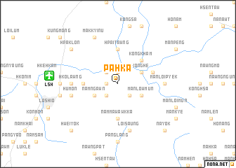
Pa-hka (Shan, Myanmar)Pa-hka is a town in the Shan region of Myanmar. An overview map of the region around Pa-hka is displayed below.
regional and 3d topo map of Pa-hka, Myanmar ::
Pa-hka airports ::
The nearest airport is LSH - Lashio, located 10.1 km west of Pa-hka.
Other airports nearby include MDL - Mandalay Intl (238.3 km south west), KET - Kengtung (260.7 km south east), Nearby towns ::
Kunhee (1.9km north) //
Mawng-ka-sai (1.7km west) //
Kong-lin (2.5km north west) //
Na-leng (2.5km north west) //
Nawng-hseng (2.5km south west) //
Kong-hka (2.5km south east) //
Konghè (3.9km north east) //
Nam-ngawn (3.9km south west) //
Mān-low-mun (3.9km south east) //
Kong-kham (5.0km north east) //
Nawa (5.1km west) //
Hpai-tawng (5.6km north) //
Nammaw-awkka (5.6km south) //
Namee (5.4km east) //
Man-loi-pyek (6.8km east) //
Hko-lawng (6.8km west) //
Hu-mon (7.1km west) //
Loi-saung (7.6km south) //
Mak Kyi-nu (8.2km north west) //
Hpaklon (8.8km north west) //
Hwei-yok (10.1km south west) //
Nā-yok (10.1km south east) //
[all distances 'as the bird flies' and approximate] 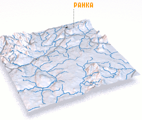 Places with similar names to Pa-hka, Myanmar ::
Disclaimer :: Information on this page comes without warranty of any kind |
||
|
Where is Pa-hka? Elevation and coordinates ::
Latitude (lat): 22°58'0"N Longitude (lon): 97°51'0"E
Elevation (approx.): 831m (map arrows pan, magnifying glasses zoom) |
||
|
Visiting Pa-hka? Hotel/Accommodation ::
Book a hotel in Pa-hka Travel Guide ::
Buy a travel guide for Myanmar rental cars ::
car rental offers GPS waypoint ::
download a GPX waypoint (PoI) of Pa-hka for your GPS receiver
|
||