|
search place name
|
||
Pegin (Mandalay, Myanmar)Pegin is a town in the Mandalay region of Myanmar. An overview map of the region around Pegin is displayed below.
regional and 3d topo map of Pegin, Myanmar ::

Pegin airports ::
The nearest airport is MDL - Mandalay Intl, located 38.4 km north west of Pegin.
Other airports nearby include HEH - Heho (97.6 km south east), LSH - Lashio (228.0 km north east), Nearby towns ::
Mondaing (0.0km north) //
Thanywa Anauk (1.7km east) //
Thanywa Ashe (2.5km north east) //
Thanywa (2.5km north east) //
Paunglaung (2.5km south east) //
Paukkon (3.4km west) //
Kyaga (3.4km west) //
Taungdaw (3.9km north east) //
Naungkan (3.9km north east) //
Tanaungdawtat (3.9km south west) //
Mezegyan (4.1km south west) //
Monnawgyi (4.1km south west) //
Ponnyetkyegyi (5.1km north west) //
Yegyi (5.1km north west) //
Thaungbyin (5.1km south west) //
Kontha (5.2km west) //
Minle (5.6km south) //
Kyauktan (5.5km east) //
Myindwin (5.8km north) //
Bongwin (5.8km south) //
Kyaukpya (6.4km north east) //
Ywashe (6.4km south west) //
Thabyeda (7.4km south) //
Kale (7.6km north) //
Myotha (7.1km west) //
Sulegon (7.1km west) //
Tada-u (7.1km west) //
Yeywa (7.1km west) //
Monnawgale (7.6km south) //
[all distances 'as the bird flies' and approximate] 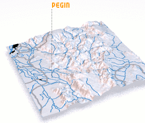 Places with similar names to Pegin, Myanmar ::
Disclaimer :: Information on this page comes without warranty of any kind |
||
|
Where is Pegin? Elevation and coordinates ::
Latitude (lat): 21°28'0"N Longitude (lon): 96°15'0"E
Elevation (approx.): 112m (map arrows pan, magnifying glasses zoom) |
||
|
Visiting Pegin? Hotel/Accommodation ::
Book a hotel in Pegin Travel Guide ::
Buy a travel guide for Myanmar rental cars ::
car rental offers GPS waypoint ::
download a GPX waypoint (PoI) of Pegin for your GPS receiver
|
||