|
search place name
|
||
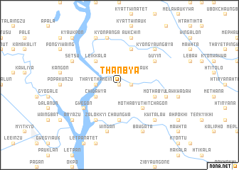
Thanbya (Myanmar)Thanbya is a town in Myanmar. An overview map of the region around Thanbya is displayed below.
regional and 3d topo map of Thanbya, Myanmar ::
Thanbya airports ::
The nearest airport is RGN - Yangon Intl, located 119.6 km south west of Thanbya.
Nearby towns ::
Thanbya Auk (0.0km north) //
Shanzu (1.9km north) //
Thanbya Atet (1.8km east) //
Kunzeik (2.6km north west) //
Kyagyaung Auk (2.6km north east) //
Kyagyaung Atet (2.6km north east) //
Kyagyaung (2.6km north east) //
Thayèthamein (3.5km west) //
Chidawya (4.0km south west) //
Leikkala (5.1km north west) //
Mothabyu Thitchagon (5.1km south east) //
Chaungwa (5.6km south) //
Mothabyu (5.6km east) //
Mothabyubya (5.6km east) //
Onbinzu (5.8km north) //
Duyin (6.5km north east) //
Zalokkyi (6.6km south west) //
Gwegon (6.5km south west) //
Kyonpa-nga (7.6km north) //
Aukchin (7.6km north) //
Wingan (7.6km south) //
Sawhti (7.3km east) //
Kwitalaw (7.7km south east) //
Kyongyaungbya (7.7km north east) //
Kyongyaung (8.2km north west) //
Setsu (8.0km north west) //
Bawgata (8.2km south east) //
Anyazu (9.0km south west) //
Kyaukpon (10.2km north west) //
[all distances 'as the bird flies' and approximate] 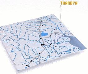 Places with similar names to Thanbya, Myanmar ::
Disclaimer :: Information on this page comes without warranty of any kind |
||
|
Where is Thanbya? Elevation and coordinates ::
Latitude (lat): 17°40'0"N Longitude (lon): 96°56'0"E
Elevation (approx.): 62m (map arrows pan, magnifying glasses zoom) |
||
|
Visiting Thanbya? Hotel/Accommodation ::
Book a hotel in Thanbya Travel Guide ::
Buy a travel guide for Myanmar rental cars ::
car rental offers GPS waypoint ::
download a GPX waypoint (PoI) of Thanbya for your GPS receiver
|
||