|
search place name
|
||
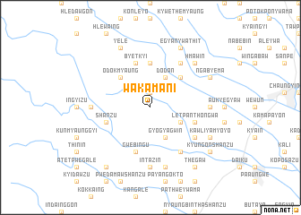
Wakama-ni (Myanmar)Wakama-ni is a town in Myanmar. An overview map of the region around Wakama-ni is displayed below.
regional and 3d topo map of Wakama-ni, Myanmar ::
Wakama-ni airports ::
The nearest airport is RGN - Yangon Intl, located 114.0 km south west of Wakama-ni.
Nearby towns ::
Sinzalok (1.9km north) //
Dodan (4.1km north east) //
Gyogyagwin (4.1km south east) //
Male Tagaung (4.0km south east) //
Tagaung (4.0km south east) //
Sapagyon (5.1km north east) //
Odokmyaung (5.1km north west) //
Ngapan-in (5.1km north west) //
Sitbogyi (5.6km north) //
Sanmyaung (5.6km north) //
Letpan-thongwa (5.6km east) //
Byetkyi (5.8km north) //
Shanzu (5.6km west) //
Gwebingu (5.8km south) //
E-gyanzu (6.6km north east) //
Natsingon (6.6km south east) //
Tagaung Kindan (6.5km south east) //
Atet Yegyaw (7.1km east) //
Yegyaw (7.1km east) //
Mayangyaung (7.1km west) //
Intazin (7.4km south) //
Thè Kindan (7.6km south) //
Hmaw-in (7.7km north east) //
Ngabyema (8.0km north east) //
Kawliya-myoyo (8.0km south east) //
E-gyan Ywathit (8.2km north east) //
E-gyan (8.2km north east) //
Yelè (8.2km north west) //
Kyungon Shanzu (9.0km south east) //
[all distances 'as the bird flies' and approximate] 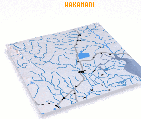 Places with similar names to Wakama-ni, Myanmar ::
Disclaimer :: Information on this page comes without warranty of any kind |
||
|
Where is Wakama-ni? Elevation and coordinates ::
Latitude (lat): 17°51'0"N Longitude (lon): 96°34'0"E
Elevation (approx.): 26m (map arrows pan, magnifying glasses zoom) |
||
|
Visiting Wakama-ni? Hotel/Accommodation ::
Book a hotel in Wakama-ni Travel Guide ::
Buy a travel guide for Myanmar rental cars ::
car rental offers GPS waypoint ::
download a GPX waypoint (PoI) of Wakama-ni for your GPS receiver
|
||