|
search place name
|
||
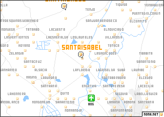
Santa Isabel (Cundinamarca, Colombia)Santa Isabel is a town in the Cundinamarca region of Colombia. An overview map of the region around Santa Isabel is displayed below.
regional and 3d topo map of Santa Isabel, Colombia ::
Santa Isabel airports ::
The nearest airport is BOG - Bogota Eldorado Intl, located 9.3 km south of Santa Isabel.
Other airports nearby include VVC - Villavicencio Vanguardia (91.6 km south east), IBE - Ibague Perales (114.5 km west), MZL - Manizales La Nubia (146.5 km west), PEI - Pereira Matecana (174.5 km west), Nearby towns ::
La Palizada (0.0km north) //
La Isla (1.9km south) //
Alejandría (1.9km south) //
Guadalajara (2.6km south east) //
La Granada (2.6km north east) //
La Florida (3.7km south) //
Buenavista (3.7km east) //
Los Laureles (3.7km north) //
La Aldea (5.2km north east) //
Las Mercedes (5.5km east) //
La Estancia (5.8km east) //
El Cerrito (5.8km west) //
Las Peñas (5.8km west) //
La Griselda (6.7km south east) //
La Esmeralda (6.7km north west) //
Engativá (7.6km south) //
Los Bebederos (7.6km west) //
Tataca (7.6km east) //
La Cuesta (7.8km north west) //
Ceuta (8.3km south west) //
La Isla (8.3km north east) //
Villa Rosa (8.3km north east) //
Cota (8.3km north east) //
San Juan de Rioseco (8.8km north east) //
La Aurora (9.2km south west) //
El Nogal (9.2km south west) //
Funza (9.3km south west) //
El Hoyo (9.2km north east) //
Santa Bárbara (9.2km south east) //
[all distances 'as the bird flies' and approximate]  Places with similar names to Santa Isabel, Colombia ::
// Santa Isabel (BR)
// Santa Isabel (BR)
// Santa Isabel (BR)
// Santa Isabel (BR)
// Santa Isabel (BR)
// Santa Isabel (BR)
// Santa Isabel (BR)
// Santa Isabel (BR)
// Santa Isabel (BR)
// Santa Isabel (BR)
Disclaimer :: Information on this page comes without warranty of any kind |
||
|
Where is Santa Isabel? Elevation and coordinates ::
Latitude (lat): 4°47'0"N Longitude (lon): 74°10'0"W
Elevation (approx.): 2553m (map arrows pan, magnifying glasses zoom) |
||
|
Visiting Santa Isabel? Hotel/Accommodation ::
Book a hotel in Santa Isabel Travel Guide ::
Buy a travel guide for Colombia rental cars ::
car rental offers GPS waypoint ::
download a GPX waypoint (PoI) of Santa Isabel for your GPS receiver
|
||