|
search place name
|
||
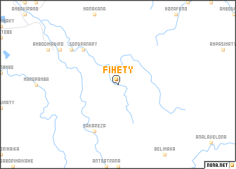
Fihety (Antsiranana, Madagascar)Fihety is a town in the Antsiranana region of Madagascar. An overview map of the region around Fihety is displayed below.
regional and 3d topo map of Fihety, Madagascar ::
Fihety airports ::
The nearest airport is AMB - Ambilobe, located 34.3 km west of Fihety.
Other airports nearby include VOH - Vohemar Vohimarina (78.4 km east), NOS - Nosy-be Fascene (104.9 km west), DIE - Antsiranana Arrachart (105.2 km north), SVB - Sambava (145.0 km south east), Nearby towns ::
Sondranary (7.8km north west) //
Sakareza (8.2km south west) //
Bobamakotra (9.1km north west) //
[all distances 'as the bird flies' and approximate] 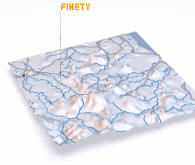 Places with similar names to Fihety, Madagascar ::
// Fahat (TD)
// Fahate (TP)
// Fahita (TP)
// Vihod (IN)
// Vāḩed (IR)
// Vāḩed (IR)
// Vaḩīd (IR)
// Féhédou (GN)
// Phú Hòa (3) (VN)
// Phú Hậu (3) (VN)
Disclaimer :: Information on this page comes without warranty of any kind |
||
|
Where is Fihety? Elevation and coordinates ::
Latitude (lat): 13°18'0"S Longitude (lon): 49°17'0"E
Elevation (approx.): 168m (map arrows pan, magnifying glasses zoom) |
||
|
Visiting Fihety? Hotel/Accommodation ::
Book a hotel in Fihety Travel Guide ::
Buy a travel guide for Madagascar rental cars ::
car rental offers GPS waypoint ::
download a GPX waypoint (PoI) of Fihety for your GPS receiver
|
||