|
search place name
|
||
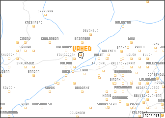
Vāḩed (Iran)Vāḩed is a town in Iran. An overview map of the region around Vāḩed is displayed below.
regional and 3d topo map of Vāḩed, Iran ::
Vāḩed airports ::
The nearest airport is RZR - Ramsar, located 61.4 km north west of Vāḩed.
Other airports nearby include THR - Teheran Mehrabad Intl (94.4 km south), RAS - Rasht (165.8 km north west), Nearby towns ::
Avījdān (1.5km west) //
Kord Maḩalleh (1.5km west) //
Ţā'eb Kolā (1.9km north) //
Kalārdasht (2.4km south west) //
Makārūd (2.5km north west) //
Pīshanbūr (2.8km north east) //
Lāhū (3.4km south) //
Ḩasan Kīf (3.3km south west) //
Ţovīdarreh (3.0km west) //
Bāzār Sar (3.7km north) //
Vālet (3.0km east) //
Valvān (3.5km south west) //
Valā Darreh (3.5km north west) //
Talī Chāl (3.5km south east) //
Kolī Chāl (3.5km south east) //
Makā' (4.8km south west) //
Ţabarsū (4.8km south east) //
‘Os̄mān Kolā (4.7km south east) //
Shakarkūh (4.5km east) //
Kūh Par (4.5km east) //
Kordī Chāl (4.6km east) //
Pey Qal‘eh (5.3km south east) //
Qaşr-e Salţanatī (5.8km south) //
Peyambūr (5.8km north) //
Kolemeh (4.9km east) //
Ajābīt (5.9km south west) //
Ābī Dasht (7.4km south) //
Mejel (7.1km south west) //
Rūdbārak (7.3km south west) //
[all distances 'as the bird flies' and approximate] 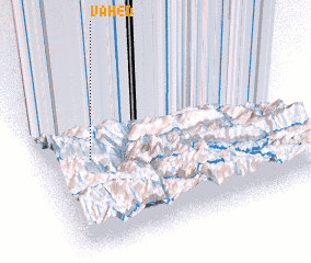 Places with similar names to Vāḩed, Iran ::
// Fihety (MG)
// Fahat (TD)
// Fahate (TP)
// Fahita (TP)
// Vihod (IN)
// Vāḩed (IR)
// Vaḩīd (IR)
// Féhédou (GN)
// Phú Hòa (3) (VN)
// Phú Hậu (3) (VN)
Disclaimer :: Information on this page comes without warranty of any kind |
||
|
Where is Vāḩed? Elevation and coordinates ::
Latitude (lat): 36°32'0"N Longitude (lon): 51°11'0"E
Elevation (approx.): 1068m (map arrows pan, magnifying glasses zoom) |
||
|
Visiting Vāḩed? Hotel/Accommodation ::
Book a hotel in Vāḩed Travel Guide ::
Buy a travel guide for Iran rental cars ::
car rental offers GPS waypoint ::
download a GPX waypoint (PoI) of Vāḩed for your GPS receiver
|
||