|
search place name
|
||
Fahat (Chari-Baguirmi, Chad)Fahat is a town in the Chari-Baguirmi region of Chad. An overview map of the region around Fahat is displayed below.
regional and 3d topo map of Fahat, Chad ::

Fahat airports ::
The nearest airport is NDJ - N'djamena Ndjamena Hassan Djamous, located 35.8 km south of Fahat.
Other airports nearby include MIU - Maiduguri (215.5 km west), MVR - Maroua Salak (234.2 km south), Nearby towns ::
Fadié (2.6km north west) //
Gas el Naal (2.6km north west) //
Tchoukoula (3.7km south) //
Djéména (4.1km south west) //
Apaga (5.2km north west) //
Ardébé (5.4km west) //
Mahana (5.8km south) //
Rizé (5.8km north) //
Moutenak (6.5km south east) //
Tom Maréfin (6.6km north west) //
Sounta (6.6km north east) //
Irébi (7.6km north) //
Mahd el Fîl (7.5km west) //
Tchoukoula (7.6km south) //
Adara Mbagol (7.8km east) //
Melgi (8.1km north west) //
Ndiobdi (8.8km east) //
Hamoud Dalla (10.3km north east) //
Goulféy (10.4km south west) //
[all distances 'as the bird flies' and approximate] 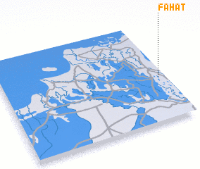 Places with similar names to Fahat, Chad ::
// Fihety (MG)
// Fahate (TP)
// Fahita (TP)
// Vihod (IN)
// Vāḩed (IR)
// Vāḩed (IR)
// Vaḩīd (IR)
// Féhédou (GN)
// Phú Hòa (3) (VN)
// Phú Hậu (3) (VN)
Disclaimer :: Information on this page comes without warranty of any kind |
||
|
Where is Fahat? Elevation and coordinates ::
Latitude (lat): 12°27'0"N Longitude (lon): 14°58'0"E
Elevation (approx.): 291m (map arrows pan, magnifying glasses zoom) |
||
|
Visiting Fahat? Hotel/Accommodation ::
Book a hotel in Fahat Travel Guide ::
Buy a travel guide for Chad rental cars ::
car rental offers GPS waypoint ::
download a GPX waypoint (PoI) of Fahat for your GPS receiver
|
||