|
search place name
|
||
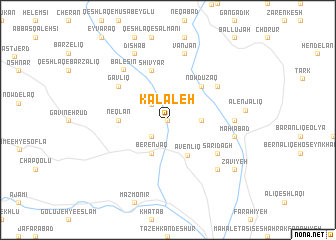
Kalāleh (Ostān-e Āz̄arbāyjān-e Sharqī, Iran)Kalāleh is a town in the Ostān-e Āz̄arbāyjān-e Sharqī region of Iran. An overview map of the region around Kalāleh is displayed below.
regional and 3d topo map of Kalāleh, Iran ::
Kalāleh airports ::
The nearest airport is TBZ - Tabriz Intl, located 139.5 km north west of Kalāleh.
Other airports nearby include RAS - Rasht (175.1 km east), Nearby towns ::
Khvājeh Deh (0.0km north) //
Īshlaq (2.2km north west) //
Chenār (2.4km south west) //
Alīnjāraq (2.4km south west) //
Şowme‘eh-ye Kabūdīn (2.9km east) //
Berenjaq (4.0km south) //
Avenlīq (4.3km south east) //
Nowdūzaq (4.7km north east) //
Neqlān (4.4km west) //
Shīvyār (5.8km north) //
Gāvlīq (5.8km north west) //
Kazaraj (5.8km north east) //
Sārī Dāgh (5.8km south east) //
Mūnaq (5.9km east) //
Bālesīn (6.9km north west) //
Vanjān (7.6km north) //
Māhīābād (6.2km east) //
Kolāmarz Chāy (6.2km east) //
Keh (7.1km south east) //
Dīshāb (8.0km north) //
Alenjālīq (6.9km east) //
Jahandīz (8.1km south east) //
Zāvīyeh (8.1km south east) //
[all distances 'as the bird flies' and approximate] 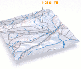 Places with similar names to Kalāleh, Iran ::
Disclaimer :: Information on this page comes without warranty of any kind |
||
|
Where is Kalāleh? Elevation and coordinates ::
Latitude (lat): 37°34'0"N Longitude (lon): 47°39'0"E
Elevation (approx.): 1418m (map arrows pan, magnifying glasses zoom) |
||
|
Visiting Kalāleh? Hotel/Accommodation ::
Book a hotel in Kalāleh Travel Guide ::
Buy a travel guide for Iran rental cars ::
car rental offers GPS waypoint ::
download a GPX waypoint (PoI) of Kalāleh for your GPS receiver
|
||