|
search place name
|
||
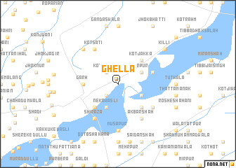
Ghella (Punjab, Pakistan)Ghella is a town in the Punjab region of Pakistan. An overview map of the region around Ghella is displayed below.
regional and 3d topo map of Ghella, Pakistan ::
Ghella airports ::
The nearest airport is LYP - Faisalabad Intl, located 55.9 km north of Ghella.
Other airports nearby include LHE - Lahore Allama Iqbal Intl (145.3 km north east), MUX - Multan Intl (175.8 km south west), ATQ - Amritsar (188.1 km north east), IXJ - Jammu (261.6 km north east), Nearby towns ::
Kot Samāil (2.4km north west) //
Mehr Shahāna (2.4km south west) //
Mīrpur (3.7km north east) //
Neka Wasli (4.0km south west) //
Kund Ālam Shāh (3.7km south east) //
Khāi (4.9km north east) //
Kot Jakka (4.9km north east) //
Mallarpur (4.9km south west) //
Kaure Shāh Zerīn (4.9km south east) //
Garh (4.8km west) //
Ālam Shāh Khagga (5.1km east) //
Shirāza (6.4km south west) //
Kot Sati (6.4km north west) //
Dakāhdi Mehr Shahāna (6.4km north west) //
Akbar Shāh (6.4km south east) //
Dādan (6.0km south east) //
Mūsāpur (7.4km south) //
Ara Tulla (7.3km north west) //
Killi (8.4km north east) //
[all distances 'as the bird flies' and approximate] 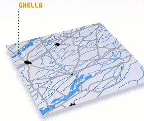 Places with similar names to Ghella, Pakistan ::
Disclaimer :: Information on this page comes without warranty of any kind |
||
|
Where is Ghella? Elevation and coordinates ::
Latitude (lat): 30°52'0"N Longitude (lon): 73°5'0"E
Elevation (approx.): 173m (map arrows pan, magnifying glasses zoom) |
||
|
Visiting Ghella? Hotel/Accommodation ::
Book a hotel in Ghella Travel Guide ::
Buy a travel guide for Pakistan rental cars ::
car rental offers GPS waypoint ::
download a GPX waypoint (PoI) of Ghella for your GPS receiver
|
||