|
search place name
|
||
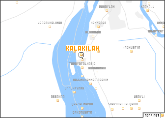
Kalākilah (Al Kharţūm, Sudan)Kalākilah is a town in the Al Kharţūm region of Sudan. An overview map of the region around Kalākilah is displayed below.
regional and 3d topo map of Kalākilah, Sudan ::
Kalākilah airports ::
The nearest airport is KRT - Khartoum, located 16.3 km north east of Kalākilah.
Nearby towns ::
Aţ Ţuwayr (0.1km south) //
Turay‘at al Masīd (2.0km south) //
Ghamarab (2.5km north west) //
Muḩammad aţ Ţurayfī (3.8km south) //
Fakī Jād Allāh (3.9km north east) //
Abū Dawmah (4.3km south east) //
Al Ḩamdāb (5.7km north east) //
Ḩājj Muḩammad Ibrāhīm (5.9km south) //
Umm Ḩarāz (7.3km south east) //
Umm ‘Uwaynah (7.8km south) //
Ḩammādāb (8.1km north east) //
Ash Shajarah (8.1km north east) //
Wad Abū Ḩalīmah (10.2km north west) //
[all distances 'as the bird flies' and approximate]  Places with similar names to Kalākilah, Sudan ::
// Kalağaylı (AZ)
// Gulgul (ER)
// Qılıçlı (AZ)
// Qılıçlı (AZ)
// Culiculi (PH)
// Gligli (PH)
// Guilaguila (PH)
// Guilguila (PH)
// Guiliguili (PH)
// Kalukalu (PH)
Disclaimer :: Information on this page comes without warranty of any kind |
||
|
Where is Kalākilah? Elevation and coordinates ::
Latitude (lat): 15°28'4"N Longitude (lon): 32°28'1"E
Elevation (approx.): 383m (map arrows pan, magnifying glasses zoom) |
||
|
Visiting Kalākilah? Hotel/Accommodation ::
Book a hotel in Kalākilah Travel Guide ::
Buy a travel guide for Sudan rental cars ::
car rental offers GPS waypoint ::
download a GPX waypoint (PoI) of Kalākilah for your GPS receiver
|
||