|
search place name
|
||
Salza Irpina (Italy)Salza Irpina is a town in Italy. An overview map of the region around Salza Irpina is displayed below.
regional and 3d topo map of Salza Irpina, Italy ::

Salza Irpina airports ::
The nearest airport is NAP - Naples Capodichino, located 50.0 km west of Salza Irpina.
Other airports nearby include FOG - Foggia Gino Lisa (79.2 km north east), BRI - Bari (159.8 km east), PSR - Pescara (178.1 km north), QLT - Latina (179.5 km north west), Nearby towns ::
Sorbo Serpico (0.0km north) //
Parolise (1.9km north) //
San Potito Ultra (2.3km north west) //
Santo Stefano del Sole (2.3km south west) //
Manocalzati (3.4km north west) //
Candida (4.0km north) //
Chiusano di San Domenico (3.4km north east) //
San Michele di Serino (4.6km south west) //
Volturara Irpina (4.6km south east) //
Montefalcione (5.6km north) //
Santa Lucia di Serino (5.6km south) //
Atripalda (4.2km west) //
Pratola Serra (7.9km north) //
Aiello del Sabato (6.7km south west) //
Ferrari (7.9km south) //
Serino (7.9km south) //
Montefredane (7.9km north west) //
Prata di Principato Ultra (8.5km north west) //
Lapio (9.3km north east) //
[all distances 'as the bird flies' and approximate] 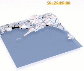 Places with similar names to Salza Irpina, Italy :: Disclaimer :: Information on this page comes without warranty of any kind |
||
|
Where is Salza Irpina? Elevation and coordinates ::
Latitude (lat): 40°55'0"N Longitude (lon): 14°53'0"E
Elevation (approx.): 460m (map arrows pan, magnifying glasses zoom) |
||
|
Visiting Salza Irpina? Hotel/Accommodation ::
Book a hotel in Salza Irpina Travel Guide ::
Buy a travel guide for Italy rental cars ::
car rental offers GPS waypoint ::
download a GPX waypoint (PoI) of Salza Irpina for your GPS receiver
|
||