|
search place name
|
||
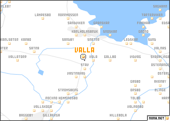
Valla (Uppsala, Sweden)Valla is a town in the Uppsala region of Sweden. An overview map of the region around Valla is displayed below.
regional and 3d topo map of Valla, Sweden ::
Valla airports ::
The nearest airport is GVX - Gavle, located 39.2 km west of Valla.
Other airports nearby include ARN - Stockholm Arlanda (92.3 km south), VST - Vasteras (112.0 km south west), BMA - Stockholm Bromma (125.2 km south), HUV - Hudiksvall (147.9 km north), Nearby towns ::
Väla (0.9km east) //
Näs (1.9km north) //
Stav (1.9km south) //
Östra Vad (3.7km south) //
Snatra (3.8km north) //
Västra Vad (3.8km south) //
Bolstan (3.8km south) //
Sandby (4.1km north west) //
Gällbo (2.7km east) //
Karlholmsbruk (5.6km north) //
Finnerånger (5.6km north) //
Nöttö (7.5km north) //
Sandviken (7.5km north) //
Domarbo (7.5km south) //
Snöskär (6.2km north east) //
Granskär (7.6km north) //
Strömsberg (7.6km south) //
[all distances 'as the bird flies' and approximate] 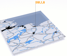 Places with similar names to Valla, Sweden ::
Disclaimer :: Information on this page comes without warranty of any kind |
||
|
Where is Valla? Elevation and coordinates ::
Latitude (lat): 60°28'0"N Longitude (lon): 17°37'0"E
(map arrows pan, magnifying glasses zoom) |
||
|
Visiting Valla? Hotel/Accommodation ::
Book a hotel in Valla Travel Guide ::
Buy a travel guide for Sweden rental cars ::
car rental offers GPS waypoint ::
download a GPX waypoint (PoI) of Valla for your GPS receiver
|
||