|
search place name
|
||
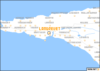
Landrevet (Bretagne, France)Landrevet is a town in the Bretagne region of France. An overview map of the region around Landrevet is displayed below.
regional and 3d topo map of Landrevet, France ::
Landrevet airports ::
The nearest airport is UIP - Quimper Pluguffan, located 28.9 km east of Landrevet.
Other airports nearby include BES - Brest Guipavas (48.9 km north), MXN - Morlaix Ploujean (85.0 km north east), LRT - Lorient Lann Bihoue (87.8 km east), LAI - Lannion (114.5 km north east), Nearby towns ::
Kergadec (0.0km north) //
Audierne (1.2km east) //
Poulgoazec (1.2km east) //
Esquibien (1.2km west) //
Kerbuzulic (2.2km north east) //
Lervily (2.2km south west) //
Lannuign (3.7km north) //
Saint-Tugen (2.5km west) //
Kervoazec (2.5km east) //
Custrem (2.5km west) //
Keriffin (5.6km north) //
Saint-Théodore (3.7km west) //
Trebeuzec (3.7km east) //
Trévern (4.2km north west) //
Goulien (5.2km north west) //
Plouhinec (5.0km east) //
Primelin (5.0km west) //
Pont-Croix (5.3km east) //
Kerydreuf-en-Plouhinec (5.3km east) //
Kerdréal (5.3km east) //
Beuzec-Cap-Sizun (7.8km north) //
Quillivic (6.2km north west) //
Penharn (7.4km north west) //
[all distances 'as the bird flies' and approximate] 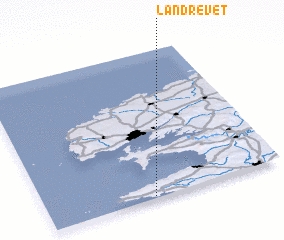 Places with similar names to Landrevet, France ::
// Leandro Oviedo (PY)
Disclaimer :: Information on this page comes without warranty of any kind |
||
|
Where is Landrevet? Elevation and coordinates ::
Latitude (lat): 48°1'0"N Longitude (lon): 4°33'0"W
Elevation (approx.): 20m (map arrows pan, magnifying glasses zoom) |
||
|
Visiting Landrevet? Hotel/Accommodation ::
Book a hotel in Landrevet Travel Guide ::
Buy a travel guide for France rental cars ::
car rental offers GPS waypoint ::
download a GPX waypoint (PoI) of Landrevet for your GPS receiver
|
||