|
search place name
|
||
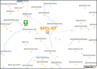
Ban I Lian (Udon Thani, Thailand)Ban I Lian is a town in the Udon Thani region of Thailand. An overview map of the region around Ban I Lian is displayed below.
regional and 3d topo map of Ban I Lian, Thailand ::
Ban I Lian airports ::
The nearest airport is UTH - Udon Thani, located 9.6 km north west of Ban I Lian.
Other airports nearby include VTE - Vientiane Wattay Intl (78.3 km north west), LOE - Loei (122.1 km west), SNO - Sakon Nakhon (134.1 km east), ZVK - Savannakhet (219.6 km south east), Nearby towns ::
Ban Nong Phai (3.0km south east) //
Ban Khao San (3.8km south west) //
Ban Nong Na Kham (4.0km north east) //
Ban Nong Wa (4.4km south east) //
Ban Dong Kheng (4.4km west) //
Ban Non Sung (7.3km south) //
Ban Kham Kling (7.0km west) //
Ban Nong Sai (7.7km north) //
Ban Nong Takai (9.1km south) //
Ban Kok Sathon (9.3km south west) //
Ban Tat (9.3km south west) //
Udon Thani (10.6km north west) //
[all distances 'as the bird flies' and approximate] 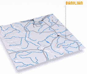 Places with similar names to Ban I Lian, Thailand ::
Disclaimer :: Information on this page comes without warranty of any kind |
||
|
Where is Ban I Lian? Elevation and coordinates ::
Latitude (lat): 17°20'36"N Longitude (lon): 102°52'0"E
Elevation (approx.): 184m (map arrows pan, magnifying glasses zoom) |
||
|
Visiting Ban I Lian? Hotel/Accommodation ::
Book a hotel in Ban I Lian Travel Guide ::
Buy a travel guide for Thailand rental cars ::
car rental offers GPS waypoint ::
download a GPX waypoint (PoI) of Ban I Lian for your GPS receiver
|
||