|
search place name
|
||
Ban I Meng (Buriram, Thailand)Ban I Meng is a town in the Buriram region of Thailand. An overview map of the region around Ban I Meng is displayed below.
regional and 3d topo map of Ban I Meng, Thailand ::

Ban I Meng airports ::
The nearest airport is NAK - Nakhon Ratchasima Khorat, located 112.4 km south west of Ban I Meng.
Other airports nearby include UTH - Udon Thani (199.8 km north), SNO - Sakon Nakhon (221.9 km north east), ZVK - Savannakhet (227.8 km north east), LOE - Loei (239.9 km north west), Nearby towns ::
Ban Nong Waeng (1.8km west) //
Ban Kae (2.6km south east) //
Ban Nong Bua Long (5.1km north east) //
Ban Nong Song Hong (6.6km south west) //
Ban Nong Wa (7.6km north) //
Ban Tha Suan Ya (8.2km south west) //
Ban Chok Tia (8.2km south east) //
Ban Thong Lang (8.0km north west) //
Ban Hai Sok (9.1km south east) //
Ban Nong Ya Khao (9.1km north west) //
Na Pho (9.0km north east) //
Ban Chok (10.3km north east) //
[all distances 'as the bird flies' and approximate] 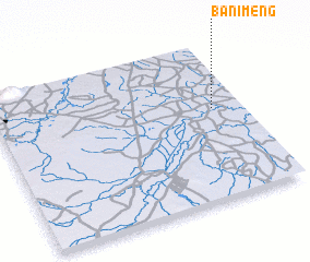 Places with similar names to Ban I Meng, Thailand ::
// Binambang (PH)
// Ban I Meng (TH)
// Ban I Meng (TH)
// Ban I Meng (TH)
// Ban I Mon Ok (TH)
// Ban Mae Ang (TH)
// Ban Mae Ing (TH)
// Ban Mae Ngao (TH)
// Ban Mai Ngae (TH)
// Ban Mang (TH)
Disclaimer :: Information on this page comes without warranty of any kind |
||
|
Where is Ban I Meng? Elevation and coordinates ::
Latitude (lat): 15°35'0"N Longitude (lon): 102°53'0"E
Elevation (approx.): 158m (map arrows pan, magnifying glasses zoom) |
||
|
Visiting Ban I Meng? Hotel/Accommodation ::
Book a hotel in Ban I Meng Travel Guide ::
Buy a travel guide for Thailand rental cars ::
car rental offers GPS waypoint ::
download a GPX waypoint (PoI) of Ban I Meng for your GPS receiver
|
||