|
search place name
|
||
Stoplin (Poland)Stoplin is a town in Poland. An overview map of the region around Stoplin is displayed below.
regional and 3d topo map of Stoplin, Poland ::

Stoplin airports ::
The nearest airport is WAW - Warsaw Okecie, located 88.6 km south east of Stoplin.
Other airports nearby include GDN - Gdansk Lecha Walesy (215.5 km north west), Nearby towns ::
Sędek (1.1km west) //
Chudzyno (2.2km north west) //
Mikołajewo (3.7km south) //
Jaroszewo Biskupie (2.2km west) //
Smardzewo (3.9km south) //
Chudzynko (3.9km north) //
Psary (3.9km north) //
Opatówiec (3.9km south) //
Przedpełce Kościołki (3.9km south) //
Cieszewko (3.9km north) //
Aleksandrowo (2.9km south west) //
Zagroba Kościelna (2.9km south west) //
Przeciszewo (2.9km north east) //
Przedpełce Kiełbasy (4.3km south east) //
Przedpełce (4.3km south east) //
Cieszewo (4.3km north east) //
Zagróbka (3.4km west) //
Brzechowo (5.6km north) //
Czerniewo (5.7km south) //
Staroźreby (3.8km south east) //
Mieczyno (3.8km north east) //
Ciołkówko (5.0km south west) //
Białęgi (5.0km south east) //
Śniegocin (5.0km south west) //
Woźniki (6.0km south) //
Ciołkowo (6.0km south) //
Maliszewko (5.0km north east) //
Woźniki Dębiny (7.5km south) //
Kozłowo (7.5km north) //
[all distances 'as the bird flies' and approximate] 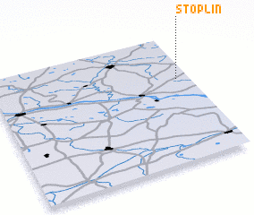 Places with similar names to Stoplin, Poland ::
// Stöpplin (DE)
Disclaimer :: Information on this page comes without warranty of any kind |
||
|
Where is Stoplin? Elevation and coordinates ::
Latitude (lat): 52°39'0"N Longitude (lon): 19°56'0"E
Elevation (approx.): 136m (map arrows pan, magnifying glasses zoom) |
||
|
Visiting Stoplin? Hotel/Accommodation ::
Book a hotel in Stoplin Travel Guide ::
Buy a travel guide for Poland rental cars ::
car rental offers GPS waypoint ::
download a GPX waypoint (PoI) of Stoplin for your GPS receiver
|
||