|
search place name
|
||
Puntuži (Madonas Rajons, Latvia)Puntuži is a town in the Madonas Rajons region of Latvia. An overview map of the region around Puntuži is displayed below.
regional and 3d topo map of Puntuži, Latvia ::
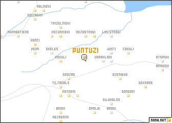
Nearby towns ::
Varakļāni (2.0km east) //
Grozas (4.2km south west) //
Mežastrodi (5.6km north) //
Rokuļi (3.1km west) //
Kokari (3.1km east) //
Justi (3.6km north east) //
Mazstrodi (5.7km north) //
Šķēles (4.5km north west) //
Čaunāni (7.5km south) //
Vecumnieki (6.3km north west) //
Lielstrodi (6.3km north east) //
Tiltagals (6.3km south west) //
Vutnēni (7.7km south) //
Oženieke (5.5km south east) //
Trizelnieki (8.0km north) //
Inčarnieki (6.9km north west) //
Stirniene (8.0km south) //
[all distances 'as the bird flies' and approximate] 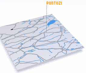 Places with similar names to Puntuži, Latvia ::
Disclaimer :: Information on this page comes without warranty of any kind |
||
|
Where is Puntuži? Elevation and coordinates ::
Latitude (lat): 56°37'0"N Longitude (lon): 26°42'0"E
Elevation (approx.): 100m (map arrows pan, magnifying glasses zoom) |
||
|
Visiting Puntuži? Hotel/Accommodation ::
Book a hotel in Puntuži Travel Guide ::
Buy a travel guide for Latvia rental cars ::
car rental offers GPS waypoint ::
download a GPX waypoint (PoI) of Puntuži for your GPS receiver
|
||