|
search place name
|
||
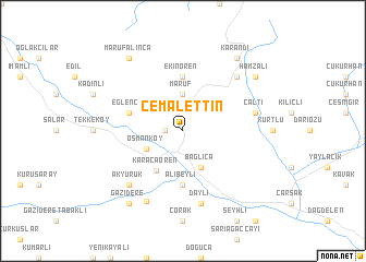
Cemalettin (Sinop, Turkey)Cemalettin is a town in the Sinop region of Turkey. An overview map of the region around Cemalettin is displayed below.
regional and 3d topo map of Cemalettin, Turkey ::
Cemalettin airports ::
The nearest airport is MZH - Merzifon, located 98.9 km south east of Cemalettin.
Other airports nearby include ESB - Ankara Esenboga (218.0 km south west), Nearby towns ::
Bektaş (1.4km west) //
Maruf (3.7km north) //
Osmanköy (3.3km south west) //
Bağlıca (4.0km south) //
Karacaören (4.6km south west) //
Ekinören (5.6km north) //
Alibeyli (5.6km south) //
Eğlence (4.6km north west) //
Daylı (7.5km south) //
Çaltı (5.8km east) //
Akyürük (6.9km south west) //
Akçakese (6.9km north east) //
Boyabat (7.7km south) //
Gazidere (8.5km south west) //
Marufalınca (8.5km north west) //
Karandi (8.5km north east) //
Hamzalı (7.9km north east) //
[all distances 'as the bird flies' and approximate]  Places with similar names to Cemalettin, Turkey ::
// Sawmill Town (US)
// Smilden (NO)
// Šmėltynė (LT)
// Smiltynai (LT)
// Smiltynė (LT)
// Smiltynė (LT)
// Smaltāni (LV)
// Smiltene (LV)
// Smiltiņi (LV)
// Cemalettin (TR)
Disclaimer :: Information on this page comes without warranty of any kind |
||
|
Where is Cemalettin? Elevation and coordinates ::
Latitude (lat): 41°32'0"N Longitude (lon): 34°48'0"E
Elevation (approx.): 341m (map arrows pan, magnifying glasses zoom) |
||
|
Visiting Cemalettin? Hotel/Accommodation ::
Book a hotel in Cemalettin Travel Guide ::
Buy a travel guide for Turkey rental cars ::
car rental offers GPS waypoint ::
download a GPX waypoint (PoI) of Cemalettin for your GPS receiver
|
||