|
search place name
|
||
Lisovody (Khmelʼnytsʼka Oblastʼ, Ukraine)Lisovody is a town in the Khmelʼnytsʼka Oblastʼ region of Ukraine. An overview map of the region around Lisovody is displayed below.
regional and 3d topo map of Lisovody, Ukraine ::

Lisovody airports ::
The nearest airport is SCV - Suceava Stefan Cel Mare, located 164.6 km south of Lisovody.
Other airports nearby include IAS - Iasi (237.6 km south), Nearby towns ::
Dubivka (3.9km south) //
Kreminna (4.4km north east) //
Posëlok Kremennaya (4.1km north east) //
Velyka Yaromyrka (6.6km south east) //
Borshchivka (7.8km north) //
Mala Yaromyrka (8.3km south east) //
Novosilka (8.9km north east) //
[all distances 'as the bird flies' and approximate] 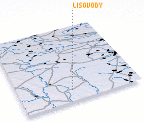 Places with similar names to Lisovody, Ukraine ::
// Lozovata (UA)
// Lozovatyy (UA)
// La Savatte (HT)
// Lisavaddy (IE)
// La Sauvatte (FR)
// La Sauveté (FR)
// La Savatte (FR)
// Lačev Do (CS)
Disclaimer :: Information on this page comes without warranty of any kind |
||
|
Where is Lisovody? Elevation and coordinates ::
Latitude (lat): 49°10'0"N Longitude (lon): 26°27'0"E
Elevation (approx.): 320m (map arrows pan, magnifying glasses zoom) |
||
|
Visiting Lisovody? Hotel/Accommodation ::
Book a hotel in Lisovody Travel Guide ::
Buy a travel guide for Ukraine rental cars ::
car rental offers GPS waypoint ::
download a GPX waypoint (PoI) of Lisovody for your GPS receiver
|
||