|
search place name
|
||
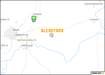
Alcántara (Andalucía, Spain)Alcántara is a town in the Andalucía region of Spain. An overview map of the region around Alcántara is displayed below.
regional and 3d topo map of Alcántara, Spain ::
Alcántara airports ::
The nearest airport is XRY - Jerez, located 8.7 km north west of Alcántara.
Other airports nearby include OZP - Sevilla Moron Ab (64.4 km north east), SVQ - Sevilla (82.1 km north), GIB - Gibraltar (83.0 km south east), TNG - Tanger Ibn Batouta (106.4 km south), Nearby towns ::
 Places with similar names to Alcántara, Spain ::
// Alcântara (PT)
// Alcoentre (PT)
// Al Qanţarah (EG)
// Alcanadre (ES)
// Alcántara (ES)
// Alcóntar (ES)
// Al Qanţārī (LB)
// Al Qunayţirah (SA)
// Al Qunayţirah (JO)
// Al Qanāţir (SY)
Disclaimer :: Information on this page comes without warranty of any kind |
||
|
Where is Alcántara? Elevation and coordinates ::
Latitude (lat): 36°41'0"N Longitude (lon): 6°0'0"W
Elevation (approx.): 103m (map arrows pan, magnifying glasses zoom) |
||
|
Visiting Alcántara? Hotel/Accommodation ::
Book a hotel in Alcántara Travel Guide ::
Buy a travel guide for Spain rental cars ::
car rental offers GPS waypoint ::
download a GPX waypoint (PoI) of Alcántara for your GPS receiver
|
||