|
search place name
|
||
Glendon (Pennsylvania, United States - USA)Glendon is a town in the Pennsylvania region of United States - USA. An overview map of the region around Glendon is displayed below.
regional and 3d topo map of Glendon, United States - USA ::

Glendon airports ::
The nearest airport is NXX - Willow Grove Nas Jrb, located 52.3 km south of Glendon.
Other airports nearby include TTN - Trenton Mercer (56.2 km south east), PHL - Philadelphia Intl (88.2 km south), EWR - Newark Liberty Intl (90.3 km east), WRI - Wrightstown Mc Guire Afb (90.7 km south east), Nearby towns ::
Browntown (0.9km north east) //
West Easton (1.4km north) //
Wilson (2.0km north) //
Easton (2.8km north east) //
Old Orchard (2.4km south west) //
Highland Park (2.4km west) //
Lincoln Terrace (3.3km north west) //
Palmer Heights (3.2km north west) //
Prospect Park (3.3km west) //
Walters (4.4km north) //
Coilton (4.9km north) //
Northwood Heights (4.8km north west) //
Dietrichtown (4.9km north east) //
Chestnut Hill (5.5km north) //
Raubsville (5.0km south east) //
Zucksville (5.9km north) //
Newburg Homes (5.2km north west) //
Phillipsburg (4.9km north east) //
Mount Hope (4.8km south west) //
Coffeetown (5.8km south east) //
Carpentersville (5.2km south east) //
Redington (5.4km south west) //
Lime Ridge (5.4km south west) //
Stouts (6.7km south) //
Shernerville (6.9km north east) //
Farmersville (5.9km west) //
Lower Saucon (7.7km south west) //
Wagnerville (6.5km west) //
Tatamy (8.5km north) //
[all distances 'as the bird flies' and approximate] 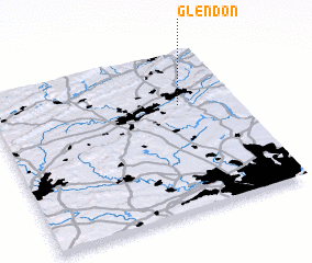 Places with similar names to Glendon, United States - USA ::
// Cline Town (SL)
// Calanutan (PH)
// Calinta-an (PH)
// Calintaan (PH)
// Calintaan (PH)
// Calintaan (PH)
// Calunetan (PH)
// Kaliantana (PH)
// Clanton (US)
// Clinton (US)
Disclaimer :: Information on this page comes without warranty of any kind |
||
|
Where is Glendon? Elevation and coordinates ::
Latitude (lat): 40°39'58"N Longitude (lon): 75°14'11"W
Elevation (approx.): 70m (map arrows pan, magnifying glasses zoom) |
||
|
Visiting Glendon? Hotel/Accommodation ::
Book a hotel in Glendon Travel Guide ::
rental cars ::
car rental offers GPS waypoint ::
download a GPX waypoint (PoI) of Glendon for your GPS receiver
|
||