|
search place name
|
||
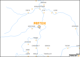
Panteik (Myanmar)Panteik is a town in Myanmar. An overview map of the region around Panteik is displayed below.
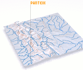
regional and 3d topo map of Panteik, Myanmar ::
Panteik airports ::
The nearest airport is MDL - Mandalay Intl, located 196.5 km east of Panteik.
Other airports nearby include AJL - Aizwal Aizawl (229.7 km north west), AKY - Sittwe (250.1 km south west), Nearby towns ::
 Places with similar names to Panteik, Myanmar ::
// Pontaga (MM)
// Pine Tuckey (US)
// Pinetucky (US)
// Pan Tak (US)
// Pentik (MY)
// Ponteggia (IT)
// Poniatówka (PL)
// Pintic (RO)
// Pintic (RO)
// Pinticu (RO)
Disclaimer :: Information on this page comes without warranty of any kind |
||
|
Where is Panteik? Elevation and coordinates ::
Latitude (lat): 22°4'0"N Longitude (lon): 94°7'0"E
Elevation (approx.): 207m (map arrows pan, magnifying glasses zoom) |
||
|
Visiting Panteik? Hotel/Accommodation ::
Book a hotel in Panteik Travel Guide ::
Buy a travel guide for Myanmar rental cars ::
car rental offers GPS waypoint ::
download a GPX waypoint (PoI) of Panteik for your GPS receiver
|
||