|
search place name
|
||
Pinticu (Covurlui, Romania)Pinticu is a town in the Covurlui region of Romania. An overview map of the region around Pinticu is displayed below.
regional and 3d topo map of Pinticu, Romania ::

Pinticu airports ::
The nearest airport is TGM - Tirgu Mures Vidrasau, located 54.4 km south of Pinticu.
Other airports nearby include CLJ - Cluj-napoca Cluj Napoca (67.1 km west), BAY - Baia Mare Tautii Magheraus (112.6 km north west), SBZ - Sibiu (133.8 km south), SUJ - Satu Mare (150.1 km north west), Nearby towns ::
Teaca (3.9km south) //
Jeica (4.5km north west) //
Doştina (4.5km south west) //
Dubiştea de Pădure (4.5km south west) //
Uricea (4.5km south west) //
Arşiţa (4.5km south west) //
Bicaşu (4.5km south west) //
Iuda (4.2km south west) //
Posnaş (5.3km north east) //
Mărişelu (7.5km north) //
Bîrla (7.5km north) //
Albeştii Bistriţei (6.3km north west) //
Măgurele (7.8km north) //
Logig (7.8km south) //
Archiud (7.5km south west) //
Şieu (9.0km north east) //
[all distances 'as the bird flies' and approximate] 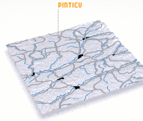 Places with similar names to Pinticu, Romania ::
// Panteik (MM)
// Pontaga (MM)
// Pine Tuckey (US)
// Pinetucky (US)
// Pan Tak (US)
// Pentik (MY)
// Ponteggia (IT)
// Poniatówka (PL)
// Pintic (RO)
// Pintic (RO)
Disclaimer :: Information on this page comes without warranty of any kind |
||
|
Where is Pinticu? Elevation and coordinates ::
Latitude (lat): 46°57'0"N Longitude (lon): 24°32'0"E
Elevation (approx.): 403m (map arrows pan, magnifying glasses zoom) |
||
|
Visiting Pinticu? Hotel/Accommodation ::
Book a hotel in Pinticu Travel Guide ::
Buy a travel guide for Romania rental cars ::
car rental offers GPS waypoint ::
download a GPX waypoint (PoI) of Pinticu for your GPS receiver
|
||