|
search place name
|
||
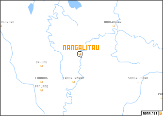
Nanga Litau (Indonesia)Nanga Litau is a town in Indonesia. An overview map of the region around Nanga Litau is displayed below.
regional and 3d topo map of Nanga Litau, Indonesia ::
Nanga Litau airports ::
The nearest airport is SQC - Sintang Susilo, located 123.1 km south west of Nanga Litau.
Other airports nearby include SBW - Sibu (200.7 km north), Nearby towns ::
Landau Ampar (5.9km south) //
Nangaboyan (10.5km north east) //
[all distances 'as the bird flies' and approximate]  Places with similar names to Nanga Litau, Indonesia ::
// Nankalet (MM)
// Nawnglat (MM)
// Nanegalito (EC)
// Nanaeklot (ID)
// Nangolet (SD)
// Nanggalotu (FJ)
// Ninnglita (ML)
// Nangalete (MZ)
// Nan Galette (HT)
// Nan Galette (HT)
Disclaimer :: Information on this page comes without warranty of any kind |
||
|
Where is Nanga Litau? Elevation and coordinates ::
Latitude (lat): 0°31'0"S Longitude (lon): 112°29'0"E
Elevation (approx.): 39m (map arrows pan, magnifying glasses zoom) |
||
|
Visiting Nanga Litau? Hotel/Accommodation ::
Book a hotel in Nanga Litau Travel Guide ::
Buy a travel guide for Indonesia rental cars ::
car rental offers GPS waypoint ::
download a GPX waypoint (PoI) of Nanga Litau for your GPS receiver
|
||