|
search place name
|
||
Nangalete (Gaza, Mozambique)Nangalete is a town in the Gaza region of Mozambique. An overview map of the region around Nangalete is displayed below.
regional and 3d topo map of Nangalete, Mozambique ::

Nangalete airports ::
The nearest airport is INH - Inhambane, located 152.5 km north east of Nangalete.
Other airports nearby include MPM - Maputo (214.7 km south west), Nearby towns ::
Cat. Metodista (3.4km north west) //
Dengoene (4.2km east) //
Chefe Chibangue (4.8km north west) //
Gafaria (5.3km south west) //
Abel (5.9km north) //
Sílvia Filimão (5.9km north) //
Regedor Nhachengo (5.4km west) //
Quimisse Cáu (6.6km north east) //
Cat. Suíça (7.2km north east) //
São Pedro e São Paulo (7.8km north) //
Cat. Metodista (7.9km east) //
Mavululane (9.1km north) //
Zandamela (9.3km north west) //
Cat. Metodista (9.5km north east) //
Chiuriane (9.7km north east) //
Chefe Barramo (9.9km north west) //
[all distances 'as the bird flies' and approximate] 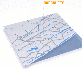 Places with similar names to Nangalete, Mozambique ::
// Nankalet (MM)
// Nawnglat (MM)
// Nanegalito (EC)
// Nanaeklot (ID)
// Nanga Litau (ID)
// Nangolet (SD)
// Nanggalotu (FJ)
// Ninnglita (ML)
// Nan Galette (HT)
// Nan Galette (HT)
Disclaimer :: Information on this page comes without warranty of any kind |
||
|
Where is Nangalete? Elevation and coordinates ::
Latitude (lat): 24°51'41"S Longitude (lon): 34°21'32"E
Elevation (approx.): 58m (map arrows pan, magnifying glasses zoom) |
||
|
Visiting Nangalete? Hotel/Accommodation ::
Book a hotel in Nangalete Travel Guide ::
Buy a travel guide for Mozambique rental cars ::
car rental offers GPS waypoint ::
download a GPX waypoint (PoI) of Nangalete for your GPS receiver
|
||