|
search place name
|
||
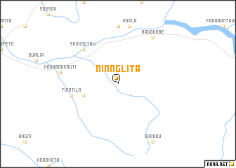
Ninnglita (Mali)Ninnglita is a town in Mali. An overview map of the region around Ninnglita is displayed below.
regional and 3d topo map of Ninnglita, Mali ::
Ninnglita airports ::
The nearest airport is KYS - Kayes Dag Dag, located 159.2 km north west of Ninnglita.
Other airports nearby include KGG - Kedougou (238.7 km south west), SEY - Selibabi Selibady (275.1 km north west), Nearby towns ::
Mansala (5.7km west) //
Tinntila (7.4km west) //
Soukoutali (7.8km north west) //
Badoumbé (9.2km north east) //
[all distances 'as the bird flies' and approximate] 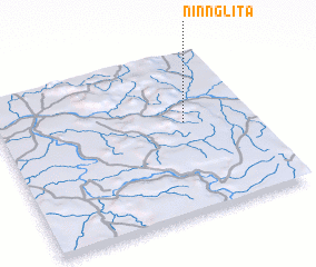 Places with similar names to Ninnglita, Mali ::
// Nankalet (MM)
// Nawnglat (MM)
// Nanegalito (EC)
// Nanaeklot (ID)
// Nanga Litau (ID)
// Nangolet (SD)
// Nanggalotu (FJ)
// Nangalete (MZ)
// Nan Galette (HT)
// Nan Galette (HT)
Disclaimer :: Information on this page comes without warranty of any kind |
||
|
Where is Ninnglita? Elevation and coordinates ::
Latitude (lat): 13°34'0"N Longitude (lon): 10°16'0"W
Elevation (approx.): 160m (map arrows pan, magnifying glasses zoom) |
||
|
Visiting Ninnglita? Hotel/Accommodation ::
Book a hotel in Ninnglita Travel Guide ::
Buy a travel guide for Mali rental cars ::
car rental offers GPS waypoint ::
download a GPX waypoint (PoI) of Ninnglita for your GPS receiver
|
||