|
search place name
|
||
Sar Tāp (Sīstān va Balūchestān, Iran)Sar Tāp is a town in the Sīstān va Balūchestān region of Iran. An overview map of the region around Sar Tāp is displayed below.
regional and 3d topo map of Sar Tāp, Iran ::

Sar Tāp airports ::
The nearest airport is ZBR - Chah Bahar, located 89.2 km south west of Sar Tāp.
Other airports nearby include GWD - Gwadar (164.1 km south east), Nearby towns ::
Būgak (4.4km south east) //
Zarīn Kahīr (5.6km north) //
Kahn-e Pā'īn (6.3km south west) //
Sheykh Kalag (6.2km south east) //
Kahn-e Pā'īn (7.0km south west) //
Kohan-e Pā'īn (7.5km south west) //
Ūshāb (7.5km south west) //
Ūshāb (7.9km south west) //
Kollānzeh (8.1km south west) //
Ābdānī (8.3km north) //
Zonnar (8.2km south east) //
Gatīvān (8.6km north west) //
Kahn-e Bālā (8.5km south west) //
Kūlī Dāp (10.0km north west) //
[all distances 'as the bird flies' and approximate] 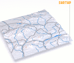 Places with similar names to Sar Tāp, Iran ::
// Surdup (BA)
// Sarıtepe (TR)
// Şārī Tappah (IQ)
// Sarytepa (UZ)
// Saurtepa (UZ)
// Zortepa (UZ)
// Sarydepe (TM)
// Sārī Tappeh (IR)
// Sārī Tappeh (IR)
// Sar Tāp (IR)
Disclaimer :: Information on this page comes without warranty of any kind |
||
|
Where is Sar Tāp? Elevation and coordinates ::
Latitude (lat): 26°3'0"N Longitude (lon): 60°58'0"E
Elevation (approx.): 323m (map arrows pan, magnifying glasses zoom) |
||
|
Visiting Sar Tāp? Hotel/Accommodation ::
Book a hotel in Sar Tāp Travel Guide ::
Buy a travel guide for Iran rental cars ::
car rental offers GPS waypoint ::
download a GPX waypoint (PoI) of Sar Tāp for your GPS receiver
|
||