|
search place name
|
||
Ban Nongkeun (Laos)Ban Nongkeun is a town in Laos. An overview map of the region around Ban Nongkeun is displayed below.
regional and 3d topo map of Ban Nongkeun, Laos ::

Ban Nongkeun airports ::
The nearest airport is VTE - Vientiane Wattay Intl, located 103.7 km south west of Ban Nongkeun.
Other airports nearby include UTH - Udon Thani (135.2 km south west), SNO - Sakon Nakhon (157.6 km south east), LPQ - Luang Prabang Luang Phabang Intl (207.7 km north west), LOE - Loei (211.5 km south west), Nearby towns ::
Ban Nahèn (1.8km east) //
Ban Pakthoay (1.8km east) //
Ban Sango (1.9km south) //
Ban Sa Ngo (1.9km south) //
Ban Hua Khua (2.6km south east) //
Ban Ho Kham (2.6km south east) //
Ban Thoay Noy (3.5km east) //
Ban A Hong (6.4km south east) //
Ban Gnoyhai (7.0km west) //
Ban Veunthat (7.3km east) //
Ban Don Po (7.6km south) //
Ban Nong Kheng (7.3km west) //
Ban Na So (10.2km south west) //
[all distances 'as the bird flies' and approximate] 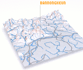 Places with similar names to Ban Nongkeun, Laos ::
// Ban Angkon (TH)
// Ban Na Nok Kok Nua (TH)
// Ban Nong Kan (TH)
// Ban Nong Kan (TH)
// Ban Angkouan (LA)
// Ban Nongkan (LA)
// Ban Nongkin (LA)
// Ban Nongkin Noy (LA)
// Ban Nong-O-Gnai (LA)
Disclaimer :: Information on this page comes without warranty of any kind |
||
|
Where is Ban Nongkeun? Elevation and coordinates ::
Latitude (lat): 18°27'0"N Longitude (lon): 103°25'0"E
Elevation (approx.): 160m (map arrows pan, magnifying glasses zoom) |
||
|
Visiting Ban Nongkeun? Hotel/Accommodation ::
Book a hotel in Ban Nongkeun Travel Guide ::
Buy a travel guide for Laos rental cars ::
car rental offers GPS waypoint ::
download a GPX waypoint (PoI) of Ban Nongkeun for your GPS receiver
|
||