|
search place name
|
||
Kager (Bayern, Germany)Kager is a town in the Bayern region of Germany. An overview map of the region around Kager is displayed below.
regional and 3d topo map of Kager, Germany ::

Kager airports ::
The nearest airport is MUC - Munich Munchen, located 103.8 km south west of Kager.
Other airports nearby include BYU - Bayreuth (124.8 km north west), NUE - Nuernberg Nurnberg (125.2 km west), KLV - Karlovy Vary (125.8 km north), FEL - Fuerstenfeldbruck Furstenfeldbruck (142.0 km south west), Nearby towns ::
Heubeckengrub (1.2km east) //
Landorf (1.9km south) //
Grub (1.9km south) //
Rißmannsdorf (1.2km west) //
Utzmannsdorf (1.2km west) //
Blundersdorf (1.2km west) //
Loitzendorf (1.2km west) //
Gittensdorf (1.9km north) //
Ried (2.2km south west) //
Weigelsberg (2.2km north west) //
Blüthensdorf (2.2km north west) //
Gossersdorf (2.4km east) //
Stallwang (3.7km south) //
Hagendorf (3.7km north) //
Großwieden (3.1km south east) //
Ichendorf (3.1km south east) //
Denkzell (3.1km south east) //
Forsting (3.9km south) //
Hintergrub (3.1km north east) //
Kölburg (3.1km north east) //
Emmersdorf (3.9km south) //
Kammersdorf (3.1km south west) //
Tragenschwand (3.9km north) //
Hermannsgrub (3.9km north) //
Thannet (3.1km north west) //
Höhenstadl (3.1km north west) //
Rottensdorf (3.1km north west) //
Habersdorf (3.9km north) //
Kohhof (3.9km north) //
[all distances 'as the bird flies' and approximate] 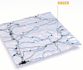 Places with similar names to Kager, Germany ::
Disclaimer :: Information on this page comes without warranty of any kind |
||
|
Where is Kager? Elevation and coordinates ::
Latitude (lat): 49°5'0"N Longitude (lon): 12°40'0"E
Elevation (approx.): 425m (map arrows pan, magnifying glasses zoom) |
||
|
Visiting Kager? Hotel/Accommodation ::
Book a hotel in Kager Travel Guide ::
Buy a travel guide for Germany rental cars ::
car rental offers GPS waypoint ::
download a GPX waypoint (PoI) of Kager for your GPS receiver
|
||