|
search place name
|
||
Kager (Bayern, Germany)Kager is a town in the Bayern region of Germany. An overview map of the region around Kager is displayed below.
regional and 3d topo map of Kager, Germany ::

Kager airports ::
The nearest airport is MUC - Munich Munchen, located 97.2 km south west of Kager.
Other airports nearby include NUE - Nuernberg Nurnberg (104.0 km north west), BYU - Bayreuth (108.9 km north west), KLV - Karlovy Vary (125.0 km north), FEL - Fuerstenfeldbruck Furstenfeldbruck (131.9 km south west), Nearby towns ::
Hetzenbach (0.0km north) //
Dangelsdorf (1.2km west) //
Hochholz (1.2km east) //
Buchendorf (1.9km north) //
Götzendorf (1.9km north) //
Steinbach (2.2km south west) //
Dürnberg (2.2km south east) //
Schillertswiesen (2.2km south east) //
Kolmberg (2.2km north west) //
Alletswind (2.2km north east) //
Wutzldorf (2.4km west) //
Haag (2.4km east) //
Woppmannsberg (2.4km east) //
Oberzell (2.4km east) //
Frauenhofen (3.9km south) //
Süssenbach (3.9km south) //
Woppmannsdorf (3.1km south west) //
Sulzbach (3.1km south west) //
Maiertshof (3.1km south west) //
Wald (3.1km north west) //
Martinsneukirchen (3.1km south east) //
Riesen (3.9km north) //
Unterzell (3.1km north east) //
Krottenthal (3.9km north) //
Treitersberg (4.4km south west) //
Siegenstein (4.4km south west) //
Gfäll (4.4km south east) //
Windhof (4.4km north west) //
Antersdorf (3.6km east) //
[all distances 'as the bird flies' and approximate] 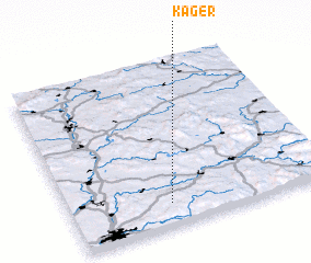 Places with similar names to Kager, Germany ::
Disclaimer :: Information on this page comes without warranty of any kind |
||
|
Where is Kager? Elevation and coordinates ::
Latitude (lat): 49°8'0"N Longitude (lon): 12°23'0"E
Elevation (approx.): 632m (map arrows pan, magnifying glasses zoom) |
||
|
Visiting Kager? Hotel/Accommodation ::
Book a hotel in Kager Travel Guide ::
Buy a travel guide for Germany rental cars ::
car rental offers GPS waypoint ::
download a GPX waypoint (PoI) of Kager for your GPS receiver
|
||