|
search place name
|
||
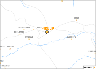
Pirdop (Sofiya, Bulgaria)Pirdop is a town in the Sofiya region of Bulgaria. An overview map of the region around Pirdop is displayed below.
regional and 3d topo map of Pirdop, Bulgaria ::
nearby GPS traces from timatio ::
Pirdop airports ::
The nearest airport is SOF - Sofia, located 63.7 km west of Pirdop.
Other airports nearby include PDV - Plovdiv (89.2 km south east), GOZ - Gorna Orechovica Gorna Oryahovitsa (134.6 km east), CRA - Craiova (181.4 km north), KVA - Kavala Megas Alexandros Intl (201.7 km south), Nearby towns ::
(( Srednogorie )) (2.3km north west) //
Zlatitsa (4.5km north west) //
Karlievo (5.8km west) //
[all distances 'as the bird flies' and approximate]  Places with similar names to Pirdop, Bulgaria ::
// Prūdupė (LT)
// Porto Pi (ES)
// Pratāp (BD)
// Poruitpa (CO)
// Parai-tepuí (VE)
// Paraytepuy (VE)
// Praitepuy (VE)
// Piratop (PG)
Disclaimer :: Information on this page comes without warranty of any kind |
||
|
Where is Pirdop? Elevation and coordinates ::
Latitude (lat): 42°42'0"N Longitude (lon): 24°11'0"E
Elevation (approx.): 673m (map arrows pan, magnifying glasses zoom) |
||
|
Visiting Pirdop? Hotel/Accommodation ::
Book a hotel in Pirdop Travel Guide ::
Buy a travel guide for Bulgaria rental cars ::
car rental offers GPS waypoint ::
download a GPX waypoint (PoI) of Pirdop for your GPS receiver
|
||