|
search place name
|
||
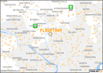
Flourtown (Pennsylvania, United States - USA)Flourtown is a town in the Pennsylvania region of United States - USA. An overview map of the region around Flourtown is displayed below.
regional and 3d topo map of Flourtown, United States - USA ::
Flourtown airports ::
The nearest airport is NXX - Willow Grove Nas Jrb, located 12.0 km north east of Flourtown.
Other airports nearby include PHL - Philadelphia Intl (25.8 km south), TTN - Trenton Mercer (39.1 km north east), WRI - Wrightstown Mc Guire Afb (53.9 km east), ILG - Wilmington New Castle (57.9 km south west), Nearby towns ::
Valley Green (0.6km north) //
Erdenheim (1.3km south) //
Arlingham (1.5km north east) //
Enfield (1.6km south east) //
Sunnybrook (1.7km north east) //
Whitemarsh (2.1km north) //
Five Points (2.1km east) //
Chestnut Hill (3.0km south) //
Gravers (3.0km south) //
Wyndmoor (3.2km south east) //
Highland (3.6km south) //
East Oreland (3.0km north east) //
Laverock (2.8km east) //
Williams (2.8km west) //
Hill Crest (2.9km east) //
Roslyn Heights (2.8km east) //
Oreland (3.4km north east) //
Lancasterville (3.4km north west) //
Fort Washington (4.3km north) //
Saint Martins (4.2km south) //
Marble Hall (3.6km west) //
Mermaid (4.0km south east) //
Ivy Hill (4.0km south east) //
Manatawna (4.5km south) //
North Hills (3.8km east) //
Mount Airy (4.9km south east) //
Broad Axe (4.8km north west) //
Edge Hill (4.2km east) //
Allen Lane (5.4km south) //
[all distances 'as the bird flies' and approximate]  Places with similar names to Flourtown, United States - USA ::
// Fullerton (US)
// Flerden (CH)
// Fullerton (US)
// Floritan (US)
// Fowlertown (US)
// Fullerton (US)
// Fowlerton (US)
// Vilarrodona (ES)
// Fullarton (ZA)
// Fullerton (US)
Disclaimer :: Information on this page comes without warranty of any kind |
||
|
Where is Flourtown? Elevation and coordinates ::
Latitude (lat): 40°6'12"N Longitude (lon): 75°12'46"W
Elevation (approx.): 60m (map arrows pan, magnifying glasses zoom) |
||
|
Visiting Flourtown? Hotel/Accommodation ::
Book a hotel in Flourtown Travel Guide ::
rental cars ::
car rental offers GPS waypoint ::
download a GPX waypoint (PoI) of Flourtown for your GPS receiver
|
||