|
search place name
|
||
Baksa (Srbija, Serbia and Montenegro)Baksa is a town in the Srbija region of Serbia and Montenegro. An overview map of the region around Baksa is displayed below.
regional and 3d topo map of Baksa, Serbia and Montenegro ::

Baksa airports ::
The nearest airport is PRN - Pristina, located 60.2 km east of Baksa.
Other airports nearby include TGD - Podgorica (88.4 km west), SKP - Skopje (122.8 km south east), TIA - Tirana Rinas (128.7 km south west), TIV - Tivat (131.0 km west), Nearby towns ::
Bramatok (1.3km south) //
Rastavica (1.6km north east) //
Prilep (2.4km north) //
Sać (1.9km west) //
Miroc (2.1km south west) //
Drenovačke Šume (2.3km north west) //
Kalavaj (2.9km south) //
Prekoluka (3.3km north east) //
Drenovac (3.7km north west) //
Junik (3.1km west) //
Babaloć (3.0km east) //
Slup (3.5km north west) //
Pepša (3.2km west) //
Pacaj (4.6km south) //
Vokša (4.0km north west) //
Dobroš (5.0km south) //
Gornji Crnobreg (4.8km north) //
Donji Crnobreg (5.0km north) //
Goč (4.0km south west) //
Beleg (5.4km north) //
Rzni° (4.7km north east) //
Dubrava (4.0km east) //
Lo°ane (5.0km north west) //
Ereč (4.4km south east) //
Nivokaz (5.3km south) //
Gramočelj (4.2km east) //
Kodralija (5.4km north east) //
Šeremet (5.8km south) //
Glođane (4.8km north east) //
[all distances 'as the bird flies' and approximate] 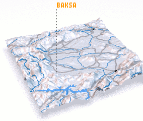 Places with similar names to Baksa, Serbia and Montenegro ::
Disclaimer :: Information on this page comes without warranty of any kind |
||
|
Where is Baksa? Elevation and coordinates ::
Latitude (lat): 42°29'10"N Longitude (lon): 20°18'44"E
Elevation (approx.): 526m (map arrows pan, magnifying glasses zoom) |
||
|
Visiting Baksa? Hotel/Accommodation ::
Book a hotel in Baksa Travel Guide ::
rental cars ::
car rental offers GPS waypoint ::
download a GPX waypoint (PoI) of Baksa for your GPS receiver
|
||