|
search place name
|
||
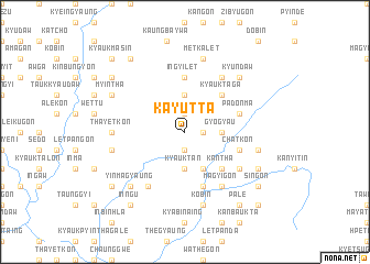
Kayutta (Sagaing, Myanmar)Kayutta is a town in the Sagaing region of Myanmar. An overview map of the region around Kayutta is displayed below.
regional and 3d topo map of Kayutta, Myanmar ::
Kayutta airports ::
The nearest airport is LSH - Lashio, located 214.0 km south east of Kayutta.
Other airports nearby include IMF - Imphal (225.6 km north west), MYT - Myitkyina (229.7 km north east), Nearby towns ::
Kainggyi-u (1.9km north) //
Nyaungbintha (1.7km east) //
Indet (1.9km south) //
Thitseingon (1.9km south) //
Taung-in (3.7km north) //
Gyogya-u (3.4km east) //
Kyauktan (3.7km south) //
Nga-gyi-aing (4.1km south east) //
Kyauktaga (5.0km north east) //
Mingon (5.0km south east) //
Kantha (5.0km south east) //
Mokwa (5.0km south east) //
O-hma (5.6km north) //
In-gyi-let (5.6km north) //
Padonma (5.4km east) //
Zigon (5.8km south) //
Pegon (5.8km south) //
Chat-kon (5.4km east) //
Thabeikkyigon (5.4km east) //
Magyi-gon (6.5km south east) //
Yun-o (6.5km north east) //
Dewa (6.5km north east) //
San-hli (6.5km south west) //
Swe-ya (6.3km south east) //
Thayetkon (6.8km west) //
Metkalet (7.6km north) //
Banbwe-gon (7.0km east) //
Kobin (7.6km south) //
Myendu (7.6km south) //
[all distances 'as the bird flies' and approximate] 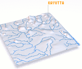 Places with similar names to Kayutta, Myanmar ::
Disclaimer :: Information on this page comes without warranty of any kind |
||
|
Where is Kayutta? Elevation and coordinates ::
Latitude (lat): 23°49'0"N Longitude (lon): 95°52'0"E
Elevation (approx.): 213m (map arrows pan, magnifying glasses zoom) |
||
|
Visiting Kayutta? Hotel/Accommodation ::
Book a hotel in Kayutta Travel Guide ::
Buy a travel guide for Myanmar rental cars ::
car rental offers GPS waypoint ::
download a GPX waypoint (PoI) of Kayutta for your GPS receiver
|
||