|
search place name
|
||
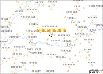
Sangsang-dong (Kangwŏn, Korea, North)Sangsang-dong is a town in the Kangwŏn region of Korea, North. An overview map of the region around Sangsang-dong is displayed below.
regional and 3d topo map of Sangsang-dong, Korea, North ::
Sangsang-dong airports ::
The nearest airport is GMP - Seoul Gimpo, located 120.0 km south of Sangsang-dong.
Other airports nearby include SSN - Seoul East Seoul Ab (130.3 km south), FNJ - Pyongyang Intl (137.6 km north west), SHO - Sokch'o Sokcho (144.9 km east), OSN - Osan Ab (169.6 km south), Nearby towns ::
Sangsangbak-kol (1.1km north east) //
Tumosu (1.3km south west) //
Sangdu-ri (1.6km south west) //
Se-gol (2.6km south west) //
Sarangt'ŏ (2.6km south east) //
Sangsangan-gol (3.0km north) //
Wangdang-ni (3.5km east) //
Kŭmgu-dong (3.7km north west) //
Kŭmgwi-gol (4.7km north west) //
Suwi-dong (4.9km south east) //
An-gol (5.3km north west) //
Chungsal-li (6.7km south) //
Sanji-ri (6.4km south west) //
Unjŏm-gol (7.2km south) //
Sinp'yŏng (5.6km west) //
Yonghŭng-ni (5.7km west) //
Waryongdam (5.8km east) //
Mayŏl-li (6.1km south west) //
Kong-gol (6.4km north west) //
Yongyŏl-li (7.1km south east) //
Tapchŏn (6.3km east) //
Tongch'ang (6.3km west) //
Kisal-li (6.7km south east) //
Kyohang (6.4km west) //
Sŏngbuk (7.6km north west) //
Chŏl-gol (6.9km west) //
Changch'ol-lodongjagu (8.3km south) //
Tongsandae (8.0km south west) //
Hoenamukŏ-ri (8.3km north east) //
[all distances 'as the bird flies' and approximate] 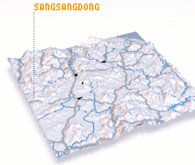 Places with similar names to Sangsang-dong, Korea, North ::
// Sangsang-dong (KP)
// Sangsŏng-dong (KP)
// Sangsŏng-dong (KP)
// Sangsong-dong (KP)
// Sangsong-dong (KP)
// Sangsŭng-dong (KP)
// Songsang-dong (KP)
// Songsŏng-dong (KP)
// Songsŏng-dong (KP)
// Songsŏng-dong (KP)
Disclaimer :: Information on this page comes without warranty of any kind |
||
|
Where is Sangsang-dong? Elevation and coordinates ::
Latitude (lat): 38°37'8"N Longitude (lon): 127°3'17"E
Elevation (approx.): 224m (map arrows pan, magnifying glasses zoom) |
||
|
Visiting Sangsang-dong? Hotel/Accommodation ::
Book a hotel in Sangsang-dong Travel Guide ::
rental cars ::
car rental offers GPS waypoint ::
download a GPX waypoint (PoI) of Sangsang-dong for your GPS receiver
|
||