|
search place name
|
||
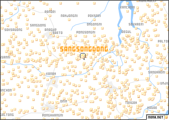
Sangsŏng-dong (Hwanghae, Korea, North)Sangsŏng-dong is a town in the Hwanghae region of Korea, North. An overview map of the region around Sangsŏng-dong is displayed below.
regional and 3d topo map of Sangsŏng-dong, Korea, North ::
Sangsŏng-dong airports ::
The nearest airport is FNJ - Pyongyang Intl, located 86.1 km north of Sangsŏng-dong.
Other airports nearby include GMP - Seoul Gimpo (146.5 km south east), SSN - Seoul East Seoul Ab (176.2 km south east), OSN - Osan Ab (198.8 km south east), Nearby towns ::
Sinhŭng-dong (0.7km south) //
Kojŏng-dong (0.7km north) //
Sŏmch'on (0.7km north west) //
Tŏksŏng-ni (0.9km north) //
Sanggo (0.9km north) //
Chŏnhŭng-dong (1.0km south) //
Sin'gung-dong (0.9km west) //
Chunggo (1.3km north) //
Hago (1.3km north east) //
Chwaha-dong (1.2km west) //
Koch'o-ri (1.4km north west) //
Chungsŏng-dong (1.4km south east) //
Chŏngnye-ri (1.7km south) //
Sundŏk-tong (1.6km south) //
Soyang-dong (1.4km west) //
Oe-dong (1.7km south) //
Hasŏng-dong (1.5km south east) //
Naesŏng-dong (1.6km east) //
Mansin-dong (2.1km north west) //
Tongsŏng-ni (2.2km north) //
Mujik-tong (2.1km north east) //
Nae-dong (2.4km south) //
Chungnimch'on (2.0km east) //
Kudun-dong (2.2km south west) //
Sinhŭng-dong (2.3km south east) //
Soyang (2.3km north west) //
Naengjŏng-dong (2.5km north east) //
Kanch'on-dong (2.3km east) //
Hausan (2.9km south) //
[all distances 'as the bird flies' and approximate] 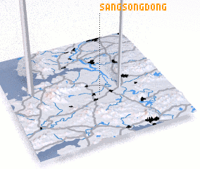 Places with similar names to Sangsŏng-dong, Korea, North ::
// Sangsang-dong (KP)
// Sangsang-dong (KP)
// Sangsŏng-dong (KP)
// Sangsong-dong (KP)
// Sangsong-dong (KP)
// Sangsŭng-dong (KP)
// Songsang-dong (KP)
// Songsŏng-dong (KP)
// Songsŏng-dong (KP)
// Songsŏng-dong (KP)
Disclaimer :: Information on this page comes without warranty of any kind |
||
|
Where is Sangsŏng-dong? Elevation and coordinates ::
Latitude (lat): 38°27'9"N Longitude (lon): 125°33'50"E
Elevation (approx.): 4m (map arrows pan, magnifying glasses zoom) |
||
|
Visiting Sangsŏng-dong? Hotel/Accommodation ::
Book a hotel in Sangsŏng-dong Travel Guide ::
rental cars ::
car rental offers GPS waypoint ::
download a GPX waypoint (PoI) of Sangsŏng-dong for your GPS receiver
|
||