|
search place name
|
||
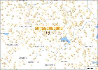
Sangsŏng-dong (Hwanghae, Korea, North)Sangsŏng-dong is a town in the Hwanghae region of Korea, North. An overview map of the region around Sangsŏng-dong is displayed below.
regional and 3d topo map of Sangsŏng-dong, Korea, North ::
Sangsŏng-dong airports ::
The nearest airport is FNJ - Pyongyang Intl, located 101.4 km north of Sangsŏng-dong.
Other airports nearby include GMP - Seoul Gimpo (136.7 km south east), SSN - Seoul East Seoul Ab (167.1 km south east), OSN - Osan Ab (187.6 km south east), Nearby towns ::
Chungsŏng-dong (0.5km north) //
Myo-gol (0.5km north east) //
Nae-dong (0.5km north east) //
Puksŏng-dong (0.7km north east) //
Mok-kol (0.9km west) //
Pun-dong (1.0km south west) //
Sangdunjŏn (1.1km south east) //
T'ŏ-gol (1.1km west) //
Wach'ŏn-dong (1.5km south) //
Songjŏng-ni (1.6km north) //
Songhyŏn-dong (1.4km north east) //
Maebong-gol (1.3km north west) //
Hasŏng-dong (1.4km north east) //
Kusŏk-tong (1.7km north west) //
Toksŏng-dong (1.5km west) //
Hadunjŏn (1.9km south east) //
Myŏngsa-ri (1.9km south east) //
Ch'ang-ch'on (1.9km south west) //
Yamyŏng-dong (1.9km south west) //
Chibong-ni (2.3km south) //
Kolmal (2.1km north west) //
Charahyŏn (1.9km west) //
Yunch'on (2.2km south east) //
Sansu-ri (2.4km north) //
Pyŏksong-dong (2.5km north) //
Hap'o-dong (2.0km east) //
Yangji-dong (2.1km north west) //
Imgyŏng-dong (2.3km north east) //
Kwangnyŏng (2.6km north) //
[all distances 'as the bird flies' and approximate]  Places with similar names to Sangsŏng-dong, Korea, North ::
// Sangsang-dong (KP)
// Sangsang-dong (KP)
// Sangsŏng-dong (KP)
// Sangsong-dong (KP)
// Sangsong-dong (KP)
// Sangsŭng-dong (KP)
// Songsang-dong (KP)
// Songsŏng-dong (KP)
// Songsŏng-dong (KP)
// Songsŏng-dong (KP)
Disclaimer :: Information on this page comes without warranty of any kind |
||
|
Where is Sangsŏng-dong? Elevation and coordinates ::
Latitude (lat): 38°18'51"N Longitude (lon): 125°33'44"E
Elevation (approx.): 64m (map arrows pan, magnifying glasses zoom) |
||
|
Visiting Sangsŏng-dong? Hotel/Accommodation ::
Book a hotel in Sangsŏng-dong Travel Guide ::
rental cars ::
car rental offers GPS waypoint ::
download a GPX waypoint (PoI) of Sangsŏng-dong for your GPS receiver
|
||