|
search place name
|
||
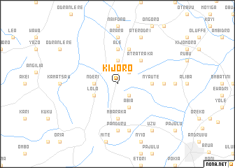
Kijoro (Busoga, Uganda)Kijoro is a town in the Busoga region of Uganda. An overview map of the region around Kijoro is displayed below.
regional and 3d topo map of Kijoro, Uganda ::
Kijoro airports ::
The nearest airport is BUX - Bunia, located 183.2 km south of Kijoro.
Other airports nearby include JUB - Juba (213.5 km north east), Nearby towns ::
Obisa (2.6km north east) //
Mingoro (2.6km south east) //
Adzuani (3.7km north) //
Nderi (3.7km west) //
Lolo (4.1km south west) //
Abia (4.1km south east) //
Atratraka (5.2km north east) //
Ale (5.6km north) //
Mbaraka (5.6km south) //
Nyaute (5.6km east) //
Maracha (5.6km east) //
Kamadi (5.9km north) //
Arara (7.4km north) //
Michu (7.4km east) //
Panduru (7.4km south) //
Adumi (7.6km south) //
Aterodri (8.3km north east) //
Uzu (9.3km south east) //
[all distances 'as the bird flies' and approximate] 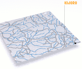 Places with similar names to Kijoro, Uganda ::
Disclaimer :: Information on this page comes without warranty of any kind |
||
|
Where is Kijoro? Elevation and coordinates ::
Latitude (lat): 3°7'0"N Longitude (lon): 30°48'0"E
Elevation (approx.): 1275m (map arrows pan, magnifying glasses zoom) |
||
|
Visiting Kijoro? Hotel/Accommodation ::
Book a hotel in Kijoro Travel Guide ::
Buy a travel guide for Uganda rental cars ::
car rental offers GPS waypoint ::
download a GPX waypoint (PoI) of Kijoro for your GPS receiver
|
||